
Mapping Education Access
Working with an early childhood education (ECE) researcher, Regionalist created a drive-time based measure of access to daycare. Using Census data to approximate locations of families with eligible children, each provider received an access score. The maps were output as Leaflet pages for use in a web browser both at the Census Tract level and individual family location level. This allowed the researcher to visualize areas of need and provided a dataset for further analysis.
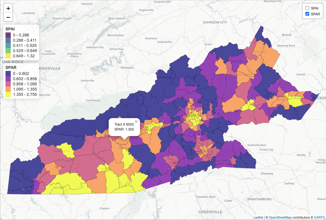
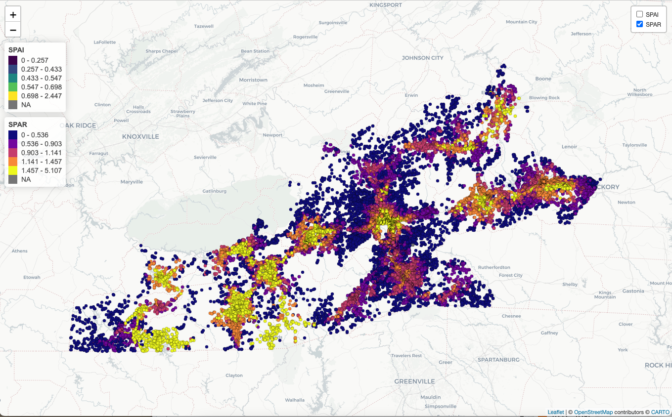
Methodology: Used an enhanced two-step floating catchment area (E2FCA) method to calculate the Spatial Access Index (SPAI) and Spatial Access Ratio (SPAR) values for early childhood education or daycare centers. E2SFCA is takes into account factors such as distance, travel time, and the availability of public transportation. Travel times for each of 40,000 homes were created with the Open Street Map Routing service. Analysis conducted in R with the sf and osrm packages.